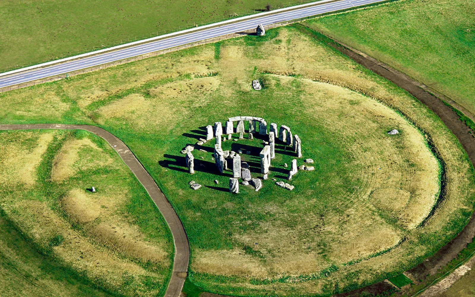
A Stonehenge map helps visitors understand how the site is arranged before arriving. The visitor centre, exhibition galleries, shuttle route, walking trail, and the stone circle are spread across open landscape. Since the monument sits about 2.4 km (1.5 miles) from the main facilities, reviewing the map makes navigating the site easier
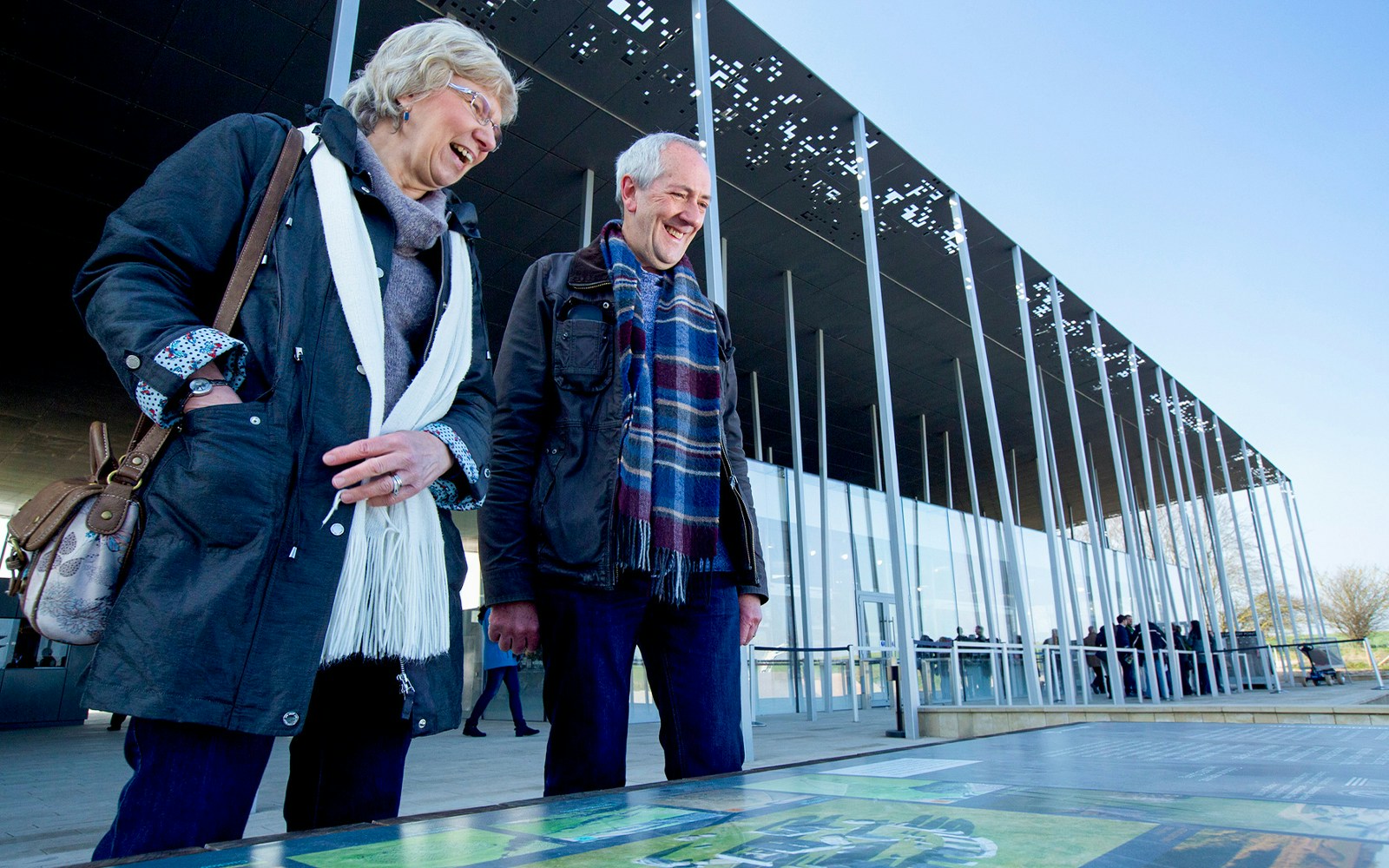
The visitor centre sits at the entrance to the site and includes ticket checks, exhibitions, café, gift shop, restrooms, and shuttle boarding points. It’s the main starting point for reaching the stone circle.
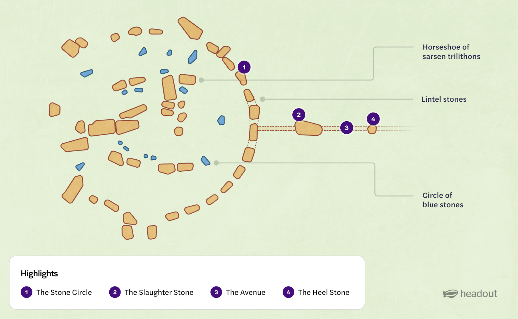
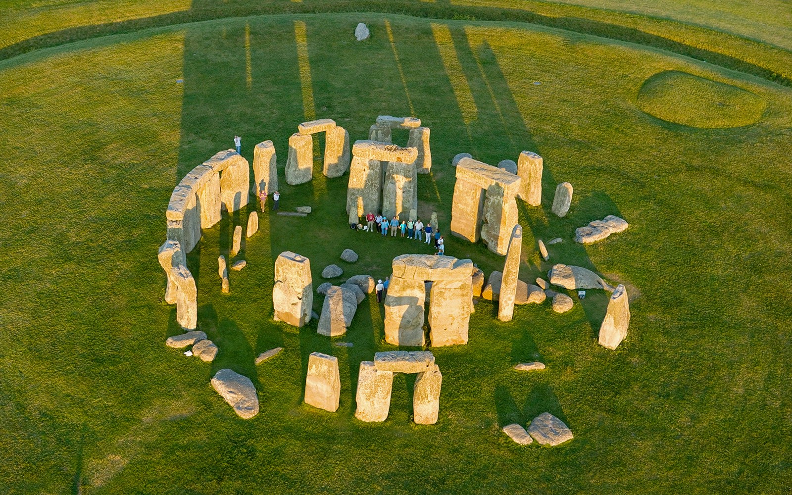
The stone circle is the main monument and sits about 1.5 miles from the visitor centre. Visitors follow a designated path around the stones while viewing features like the Heel Stone.
The Slaughter Stone lies near the entrance to the stone circle along the ancient approach route. This large fallen sarsen once stood upright and now marks part of the ceremonial pathway leading toward the monument.
The Avenue is a prehistoric processional pathway that connects the stone circle to the River Avon. This long earthwork aligns with the summer solstice sunrise and marks the ceremonial approach to the monument.
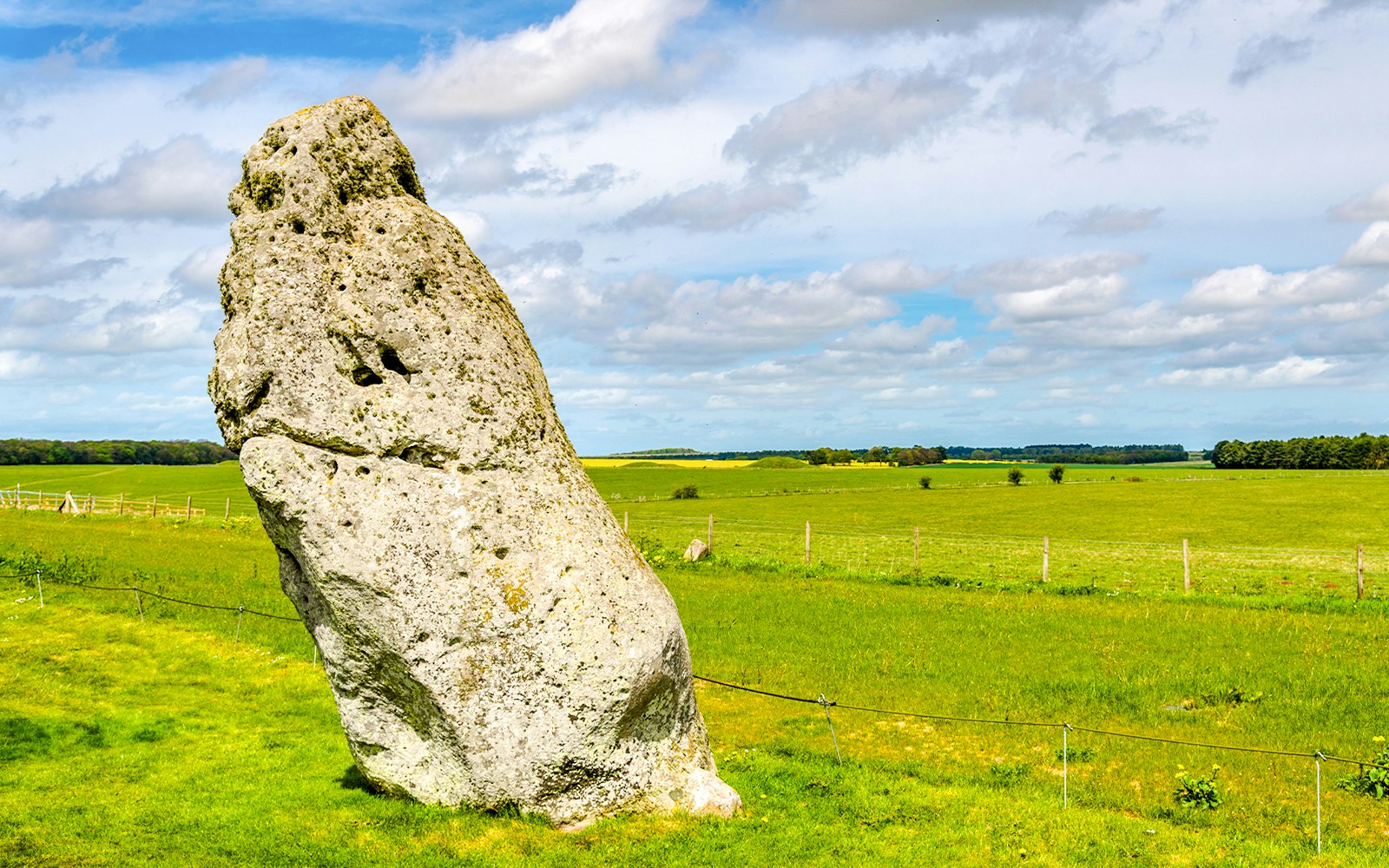
The Heel Stone stands just outside the stone circle along the Avenue. During the summer solstice, the rising sun appears directly above this stone when viewed from the centre of the monument.
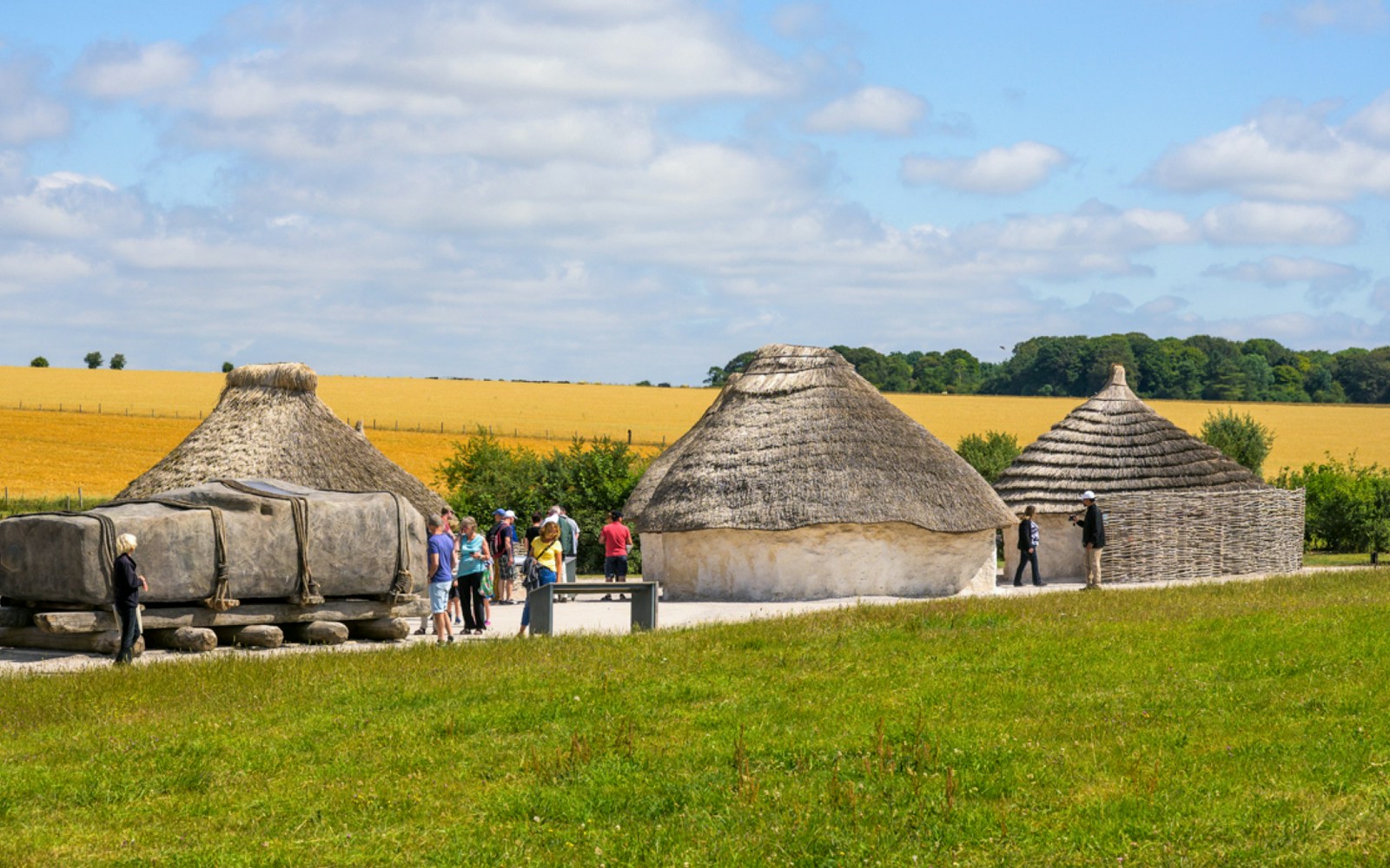
Near the visitor centre, reconstructed Neolithic houses show how people may have lived around 2500 BCE. Demonstrations here often explain ancient building methods, cooking practices, and daily life.
Stonehenge is located on Salisbury Plain in Wiltshire, England, about 13 kilometres north of Salisbury and roughly 140 kilometres southwest of London.
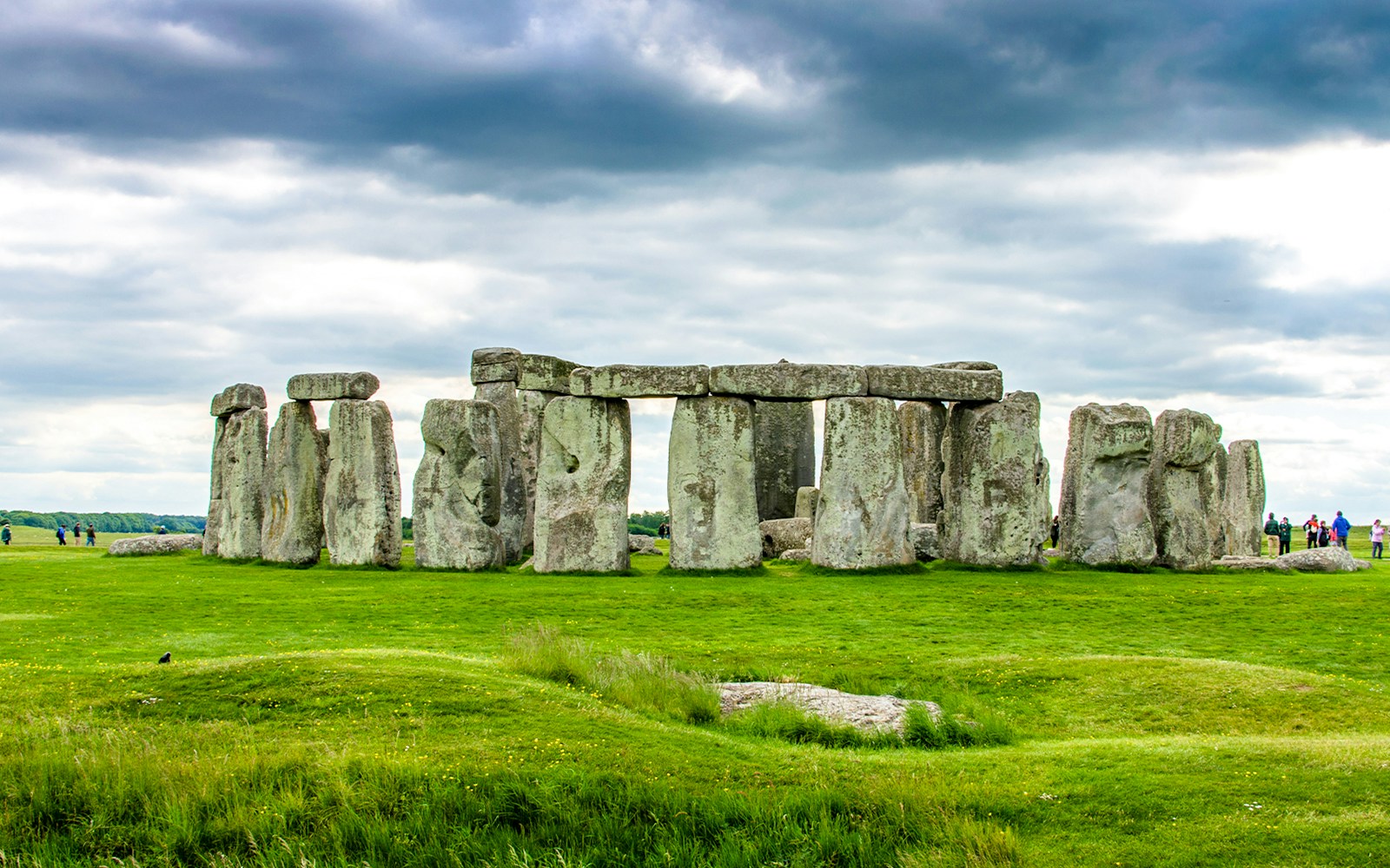
Stonehenge is famous as one of the world’s most recognizable prehistoric monuments, known for its massive standing stones and precise alignment with the solstices.
Stonehenge was constructed in several stages between around 3000 BCE and 2000 BCE. Archaeologists believe it served ceremonial, burial, and astronomical purposes.
The visitor centre sits about 2.4 km (1.5 miles) from the stone circle, connected by a walking path and an electric shuttle service.
Yes. A dedicated walking route leads from the visitor centre to the stone circle across Salisbury Plain and usually takes around 25 to 30 minutes.
Yes. Electric shuttle buses operate regularly between the visitor centre and the monument throughout the day, providing a quicker alternative to walking.
The visitor centre includes ticketing areas, exhibitions, restrooms, a café, gift shop, shuttle boarding points, and reconstructed Neolithic houses.
General visitors follow a pathway around the outside of the stone circle. Special access tours allow small groups to enter the circle outside regular hours.
Yes. The surrounding landscape includes burial mounds, ancient pathways, and ceremonial sites that form part of the wider Stonehenge prehistoric landscape.
A site map helps visitors understand the layout between the visitor centre and monument, identify walking routes, and locate exhibitions, shuttle stops, and facilities.

From London: Stonehenge Half-Day Trip
From London: Stonehenge, Windsor & Oxford Full Day Trip
From London: Stonehenge, Windsor Castle & Bath Full-Day Trip
Stonehenge & Bath Full-Day Tour with Transfers & Optional Roman Baths Tickets
Stonehenge, Windsor Castle and Bath with Pub Lunch in Lacock
From London: Stonehenge and Bath Day Trip
From London: Stonehenge and Windsor Day Trip